This pioneering study on healthy and sustainable indicators for Jakarta is the first in Indonesia to use the Global Healthy and Sustainable City Indicators framework. As the most populous city in Indonesia and Southeast Asia, Jakarta’s inclusion provides valuable insights into its status compared to 25 international cities. We offer a critical perspective on existing spatial indicators, highlighting the need for precise definitions and careful interpretation within the city’s local context. Additionally, we propose new indicators to help policymakers and public health officials develop more adaptable measures for urban health and sustainability.

For perestrain-friendly cities, many studies have tried to show the positive outcomes with different quantitative and qualitative analyses worldwide. However, there are almost no studies that focus on citizens’ points of view and how they experience these positive outcomes. Our study aims to fill this gap. We show that designing walkable cities can change people’s perception of space and have positive effects.
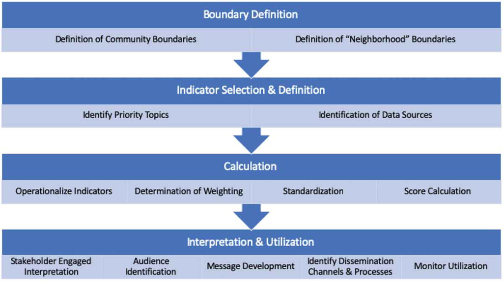
There are so many neighbourhood-level drivers that impact our health that making sense of all the data can be difficult. This tool helps us understand

