

City Know-hows
Target audience
City council public health and transport officers
The problem
Urban health studies usually focus on the differences between neighbourhoods in the same city; however, that approach lacks any assessment of the overarching forces affecting the city as a whole.
What we did and why
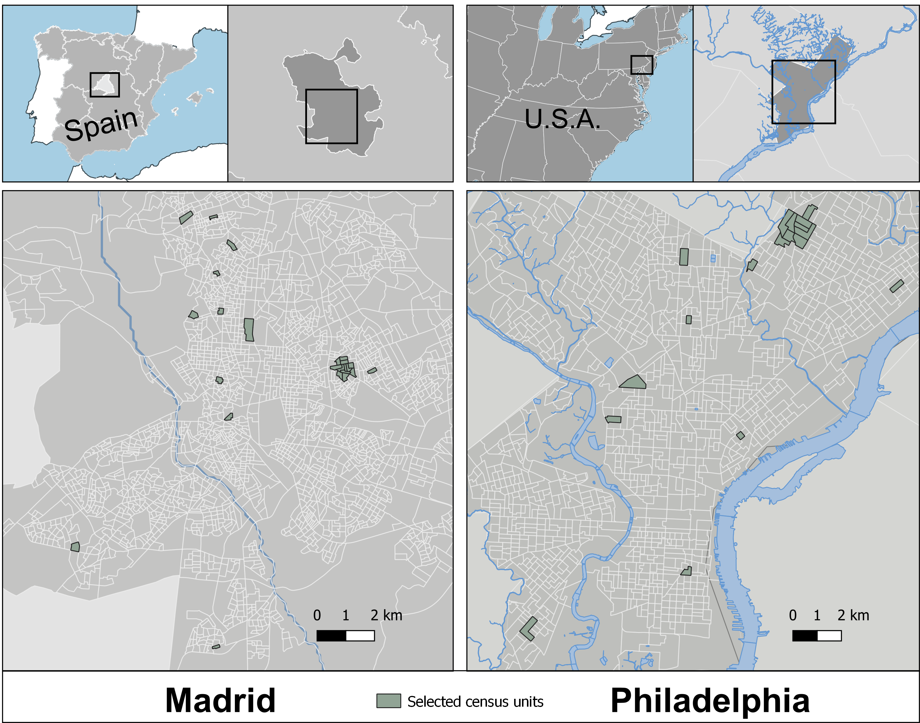
We compared differences in the walking environment between Madrid and Philadelphia. We used an audit tool called M-SPACES that measures, for each street segment;
Our study’s contribution
We found that Philadelphia’s streets had higher scores for function (physical attributes that supported walking) and safety, while Madrid streets had greater a greater proportion of streets having at least one walking destinations. These results are key to understand which elements of the built environment could be key to uncover mass influences that operate at the city level.
Impacts for city policy and practice
In order to understand which urban characteristics impact on physical activity and health, we need to understand what characterize our cities as a whole. In our study, Madrid is characterized by a higher proportion of daily walking destinations, while the streets of Philadelphia have better physical infrastructure for walking in the street.
Future studies should include attention to the potential impact of built environment characteristics at the city level.
Further information
Authors: Pedro Gullón (@pgullon), Usama Bilal (@usama_bilal), Patricia Sánchez, Julia Díez (@JuliaDiez91), Gina S. Lovasi, and Manuel Franco (@mfranco_uah)
Full research article:
Related posts

With new advances in public participation Geographic Information Systems and the increasing use such these tools for participatory mapping of various spatial data, urban designers need to understand the usefulness of these tools in investigating micro-scale physical characteristics of urban settings.

We worked with 82 primary school children (aged 9-10) from four schools and neighbourhoods in Newcastle upon Tyne, UK. Through focus group discussions, we asked them to share their travel experience in their neighbourhoods. Using age-appropriate maps and playful stickers, we gathered insights into their experiences, to identify patterns in what children need from their neighbouhoods. In addition, we mapped their comments to specific locations to better understand the relationships between the built environment features and children’s experiences.

Transportation planners and transit authorities must gain a better understanding of the passenger and ridership experience for those specific demographics who frequently use their services. This understanding can inform future improvements and help transit authorities work towards Universal Design.