
My findings suggest that some indicators of neighbourhood physical disorder—specifically the presence of noise, graffiti, and vandalism—are associated with a greater risk for some mental health problems in children, while markers of neighbourhood physical order—neighbourhood cleanliness and well-cared-for dwellings—may have a protective effect.

Deaths by suicide are the leading cause of violent death. Suicide is a silent plague that is killing people daily in different cities and towns of Spain. Is the type of settlement and air temperature affecting the probability of killing yourself? What we can deduce from statistical models.
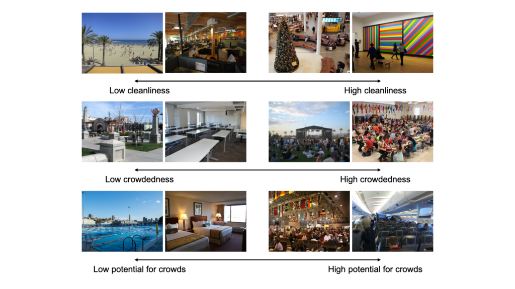
How do people conceptualize pathogen transmission risk in cities using visible cues?